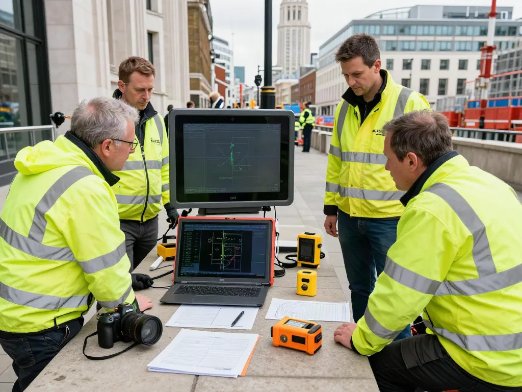
Understanding Underground Utility Surveys
In today's complex urban environments, the need for precise and reliable information about underground utilities has never been more critical. Underground utility surveys play a vital role in construction, infrastructure development, and safety management by revealing the location, depth, and nature of buried utility services. These surveys employ advanced technologies and methodologies to mitigate risks associated with construction projects and ensure compliance with regulations. When exploring options, Underground Utility Survey London provides comprehensive insights into effective utility mapping solutions.
What is an Underground Utility Survey?
An underground utility survey is a systematic investigation aimed at identifying and mapping the various utilities buried beneath the ground. Utilities may include water pipes, gas mains, electricity cables, telecommunications lines, and sewage systems. The survey process typically involves using sophisticated equipment such as Ground Penetrating Radar (GPR), electromagnetic locators, and CCTV technology to accurately detect and map these utilities. By understanding the subsurface environment, stakeholders can better plan construction and maintenance activities, ensuring minimal disruption and enhanced safety.
Importance of Utility Mapping for Construction Projects
Utility mapping is crucial for construction projects, particularly in dense urban areas like London, where multiple utilities often converge. Identifying the exact location of underground services before commencing any excavation work can prevent potentially hazardous accidents, such as striking a live gas line or a water main. Not only does this protect workers and the public, but it also reduces delays and additional costs that can arise from accidental damage to utilities. Effective utility mapping ensures that construction projects adhere to safety regulations and are executed smoothly.
Technologies Used in Underground Utility Surveys
Modern underground utility surveys utilise a variety of technologies to detect and map utilities effectively. Key technologies include:
- Ground Penetrating Radar (GPR): This non-destructive method uses radar pulses to image the subsurface, making it ideal for locating a wide array of utilities.
- Electromagnetic Locators: These devices detect electromagnetic fields, allowing surveyors to locate conductive materials such as metallic pipes and cables.
- CCTV Surveys: Used primarily for inspecting sewer systems, these cameras provide real-time visuals of underground infrastructure, revealing potential issues like blockages or damage.
Benefits of Conducting Underground Utility Surveys
Preventing Disruptions and Accidents
One of the primary benefits of conducting underground utility surveys is the prevention of accidents and disruptions during construction. By accurately mapping the location of utilities, contractors can formulate more effective excavation plans that avoid utility strikes. This not only safeguards the workforce but also protects the public and reduces the potential for costly project delays.
Cost Savings Through Accurate Planning
Accurate utility mapping provides significant cost savings by enhancing project planning. Knowing the precise location and depth of utilities allows construction teams to optimise equipment usage and workflow, leading to efficient use of resources. A well-executed underground utility survey can save time and money, translating to more budget-friendly projects and increased profit margins.
Enhancing Project Efficiency and Safety
With comprehensive data from underground utility surveys, project managers can make informed decisions that enhance operational efficiency. By mitigating risks associated with unforeseen underground obstacles, teams can maintain construction schedules and ensure site safety. Enhanced efficiency not only leads to smoother project execution but also improves stakeholder confidence and satisfaction.
Best Practices for Underground Utility Surveys
Choosing the Right Survey Method
Selecting the appropriate survey method is crucial for obtaining accurate results. Factors to consider include the type of utilities present, the depth of these utilities, and the specific site conditions. For example, GPR is ideal for locating non-metallic utilities, while electromagnetic locators excel in detecting metallic pipes and cables. Collaborating with experienced survey professionals can help determine the best approach for each unique project.
Compliance with PAS128 Standards
Ensuring compliance with industry standards, such as PAS128, is essential when conducting underground utility surveys. PAS128 outlines the methodology for utility detection, mapping, and reporting, ensuring that the survey is performed to a high standard of accuracy and reliability. Adhering to these guidelines not only enhances the quality of the survey results but also guarantees that the information provided is useful for clients and stakeholders.
Collaborating with Experienced Survey Teams
Engaging experienced survey teams is crucial for the success of underground utility surveys. Skilled surveyors bring expertise in utilising advanced technologies and interpreting the data collected. Their knowledge of local regulations and standards also ensures that surveys are completed efficiently and accurately. Therefore, it is advisable to partner with established surveying companies, particularly those with a track record in the region.
Challenges in Underground Utility Surveying
Common Misconceptions About Utility Surveys
There are several misconceptions surrounding underground utility surveys. One common myth is that utility mapping is only necessary for large-scale projects, whereas, in reality, even small projects can benefit significantly from accurate utility data. Additionally, some people believe that all utilities can be easily detected using technology, neglecting the fact that certain factors, such as soil conditions and type of utility, can impact survey efficacy.
Navigating Legal and Regulatory Hurdles
Commencing utility surveys may involve navigating various legal and regulatory challenges. Different areas have specific regulations governing excavation and utility identification, which can vary significantly between locations. It's crucial for surveying teams to be aware of these regulations and collaborate with local authorities to ensure compliance and avoid legal issues.
Dealing with Complex Urban Environments
Urban environments present unique challenges for underground utility surveys. The densely packed infrastructure can make it difficult to locate specific utilities accurately. Additionally, the presence of multiple overlapping services poses challenges in data interpretation. Surveyors must deploy advanced techniques and tools to navigate these complexities and provide reliable results.
The Future of Underground Utility Surveys in 2026
Emerging Technologies and Innovations
Looking to the future, the underground utility survey industry is expected to be transformed by emerging technologies. Innovations such as Artificial Intelligence (AI) and machine learning algorithms will enhance data analysis and utility mapping precision. Furthermore, advancements in drone technology may allow for quicker and more efficient surveys, providing 3D mapping capabilities that can redefine project planning and implementation.
Predicted Trends in Utility Management
As urban areas continue to evolve, there will be a growing emphasis on proactive utility management. This includes integrating utility surveys into long-term urban planning to anticipate infrastructure needs and minimise disruptions. Enhanced data analytics will enable municipalities to optimally manage their utility resources and develop sustainable urban environments.
Preparing for Sustainable Urban Development
With the increasing focus on sustainability, underground utility surveys will play a vital role in future urban development. Understanding the location and condition of existing utilities is essential for planning green spaces and new infrastructures, such as smart cities that rely on interconnected technologies. Sustainable development will require accurate mapping to ensure that future projects are environmentally friendly and efficient.
How to check for underground utilities in the UK?
To check for underground utilities in the UK, individuals and contractors can consult utility companies for maps of their pipelines and cables or hire professional surveyors who use advanced detection technologies. It is essential to plan surveys in advance, especially for projects that require excavation, to ensure safety and compliance.
How much does a home survey typically cost in London?
The cost of a home survey in London can vary widely depending on the property's size, the complexity of the survey, and the types of utilities present. On average, homeowners may expect to pay between £300 and £1,000 for comprehensive surveys, including underground utility assessments.
How much does a geophysical survey cost?
The cost of a geophysical survey can also vary based on several factors, including the site conditions and the equipment required. Typically, prices can range from £1,000 to £3,000, depending on project specifics and the depth of the utilities being surveyed.
What are the best survey companies in the UK?
Determining the best surveying companies in the UK can depend on various factors, including location, expertise, and past project successes. Companies such as Cadmap, Omega Geo, and Terrain Surveys are renowned for their reliability and professionalism in conducting underground utility surveys across the UK.
What are the implications of not surveying underground utilities?
Failing to conduct underground utility surveys can result in severe implications, including accidental utility strikes, project delays, and safety hazards. In worst-case scenarios, these issues can lead to serious injuries, legal liabilities, and significant financial losses. Hence, conducting thorough underground utility surveys is crucial for any construction or excavation project.